The Sony A77’s swan photo.
This photo of a dirt road is the last I took before a travel photographer’s worst nightmare struck. During a cold-stomached panic, all efforts to revive my camera were futile and for reasons I will never know, it was toast. With help out of reach, I strapped my substitute photographic device (iPad) to my chest and continued pushing through the forest like a grizzled woodland teletubby.
For as long as I remember, I’ve had a love of fishing. At our family house in the remote woods of upstate New York, my father and I would hike to a lake through the woods and we’d fish away the afternoon. Later in life, whenever I was in the need of peace or a freshly caught meal, I’d drive up there, walk through the forest and sit by the water with my rod and thoughts.
So when I read about the Livonian coast in north west Latvia, an 80km stretch of unspoiled coastline dotted with 12 historical fishing villages, I just had to go. It’s been a decade since I’ve fished, but I could experience it vicariously. I would walk the entire way, stop at each village, eat fish at ramshackle seaside cafés, chat with locals and learn about their traditional way of life. Perhaps, just like when I was young, one of the old fisherman would let me ride in their boat and cast a line or two.
The day before, my spirits were high when I left my starting point in the city of Ventspils. I marched northwards through the hot sandy beach of the Baltic sea, sweating and aching but excited. 15km later, I reached the first village of Liepene and spotted my first fishing boats. But none were at sea, but dragged up on shore, seemingly decades ago and left to bake in the hot sun like tombstones marking the old way of life.

Photo taken with Sony A77, by Nicholas Orloff.

Photo taken with iPad.
There was no fishing going on.
Not in Liepene, or the next village of Targale, or Luzņa after that. I felt stupid. How could I not have known? What happened? My dream of experiencing the simple fishing life swam away. Then the following afternoon the camera tragedy struck. A fleeting thought of quitting and returning to Riga flew through my head—this journey was pointless. And walking along the sea in the deep sand was too tough with heavy boots, and there was nothing for me to discover here.
But the wild Latvian forest hugging the beach beckoned me with a promise of a fresh start—a long walk with nothing to photograph and to reminisce those days long ago walking through New York forests with the fishing lake at the end of the trails as my reward. Fishing was no longer a reward here, but the seaside at Cape Kolka was. Close enough.
The north western Latvian forest is wild and unmaintained. I quickly found the trails are tricky—often they narrow before trees swallow them, leaving me no choice but to cut through the wilderness without a path to follow.

Dead end. Photo taken with iPad.
The soft static white noise of the Baltic Sea’s waves crashing into the coast far to the west proved a more reliable means of navigation than a compass. Often turning back was not an option. Confusion sets in as I turn around to backtrack and find two paths forking out behind me. The forest spins around and folds in around me, like it’s sucking me in and thwarting exit. The loneliness of this forest was a lie and I was convinced that something was always watching me. I keep moving, sweating from the humidity and inventing dangers in my mind, and just when I’m questioning the ability to leave, the trail gives way to an incongruously placed road.

Road to nowhere. Photo taken with iPad.
Overgrown with grass and weeds sprouting tall from the disintegrating pavement, it’s clear that neither feet nor wheels have beaten this old road for weeks. Who built them, I wonder, and why here?
By the end of my second day, having slept in an empty campsite the night before and rationing cheese, bread and dried meat carried from Ventspils, my chemical repellent soaked face slices through clouds of hungry mosquitos as I push forward. In my discomfort, I keep telling myself that barring severe injury, victimization by crime or arrest, it’s impossible to have a trip ruined. You can’t control what gets thrown your way.
But you can control your mindset. I let fishing and photography drop from my mind. And then something interesting happened.
By the third morning my senses heightened. I zeroed in on the scent of the forest–wet, fresh dirt cleansed by the wind from the sea filtered through the tangle of trees. Another reminder of my childhood summers in the woods, the smell of freshly dug gardens that old Russian ladies kept on their front lawns, lining the the rough gravel road in the forest that my grandfather’s generation built their dachas on. But those old ladies, and the rest of that generation, are gone. And their gardens and homes are reclaimed by the forest.
I couldn’t shake the idea that everything eventually becomes a graveyard. Not because I’m morbid, but because what I found—an old military bunker sprouting from the forest carpet undergrowth like a mushroom. Or a tombstone.

Military mausoleum. Photo taken with iPad.
I knew that Latvia was subjected to countless invasions, occupations, resettlements, crusades and wars. But I did not expect to see any evidence of this in the middle of the woods.
Was a war actually fought here? Can there be soldiers’ skeletons hidden just beneath the brush? This was the type of place you could find a body that’s been hiding for months, maybe years. And speaking of bodies, what if I fell and broke my leg? Nobody would find me, for nobody would be able to hear me. But that wouldn’t matter, because there were no people here—I haven’t seen anyone for two days.
As I moved, more tombstones, mausoleums and skeletons appeared.

Watchtower. Photo taken with Nicholas Orloff’s iPad.

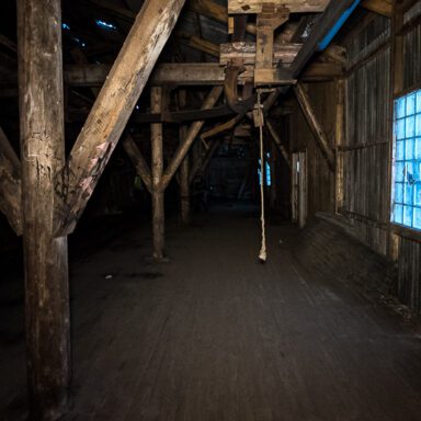
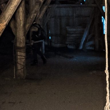
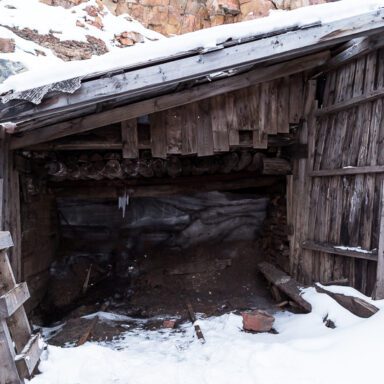
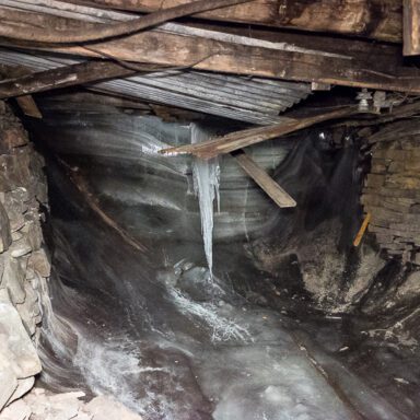
Structure of unknown origin and purpose. Photo taken with Sony A77.

Gun nest. Photo taken with Sony A77.
This stretch of coastline and the forest behind it was indeed a graveyard, for a war that never happened.
Later, I learned from locals that the Soviets militarized this coast after they reoccupied Latvia from Nazi Germany in 1944. They built a base and surrounded it with missile launchers and watchtowers. They carved a network of roads through the forest to move equipment and tanks.
Why? Because Cape Kolka was strategically important for it guards the Irbe Strait, the entrance to the Gulf of Riga. The Latvian coastline was now a USSR border and thus became a pawn in cold war paranoia, needing protection from possible invasion. And to aid that cause, many Livonians were forced out or deported to make way for the military. Those who were left needed special permits to enter and leave and the coast was off limits to anyone else. Restrictions on sailing rendered the Livonians’ boats useless for their intended purpose. So they dragged them back to their homesteads and they remained as tombstones marking the old way of life ever since.
And this is how the fishing died.
At the end day four I punch through tree line to greet the sun and sand I ran from before. Reinvigorated by the cool wind from the dark blue sea, I push through fifty hours’ worth of pain for the final push to Kolka along the beach, passing more clues of the militarized past along the way.

Standoff by the sea. Photo taken with iPad.
At the Cape, the sea and trees clash in a battle of erosion. Straddling the front line, with my left foot sinking in the sand of the beach and my right crunching through brush, I walk through two worlds at once, taking my time to circumnavigate the cape in the cool breezy air without sweat or purpose.

Battle by the sea. Photo taken with iPad.
That evening, after luxuriously bathing in brown gritty well water I rest on the patio of an ancient family farmhouse turned guesthouse, sipping from a mug of yeast sweet kvas and picking at a plate of salty, pungent smoked fish. I muster up the energy for a final walk as the sun starts its leisurely descent, visiting icons of history that survived to carry on traditions to this day.

Russian Orthodox church. Photo taken with iPad.
When you let go from a story that’s not working, you free yourself to discover a new one. The unintended consequence of my broken camera and abandoned plans was finding a story of unintended consequences—a story of how 50 years of military occupation and isolation kept a forest and coastline pristine and preserved. And today, the Latvian government is keeping it that way, as the Livonian coast is a protected national park for all to enjoy.
And as the sun disappeared below the water line, leaving the Cape in warm, wonderful pink and purple light, I finally found who and what I first set out to find.

Alone with rods and thoughts. Photo taken with iPad.